
Just some notes on how and why the maps happened, for future reference.
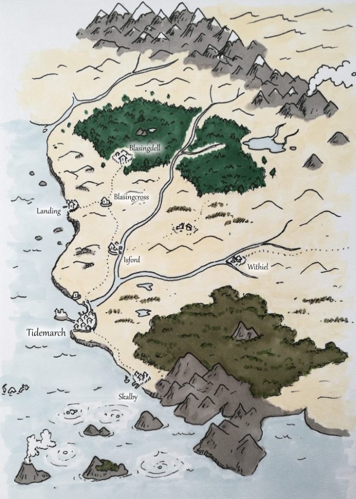
Smaller maps for an overview of the campaign's starting area, random encounters, and so on.
The bold blocks of colour can give an interesting effect, but it's hard for me to get softer effects. Done in a small moleskine, which is portable, and the paper is quite fine and smooth for relatively easy detailing.
| |
|
|
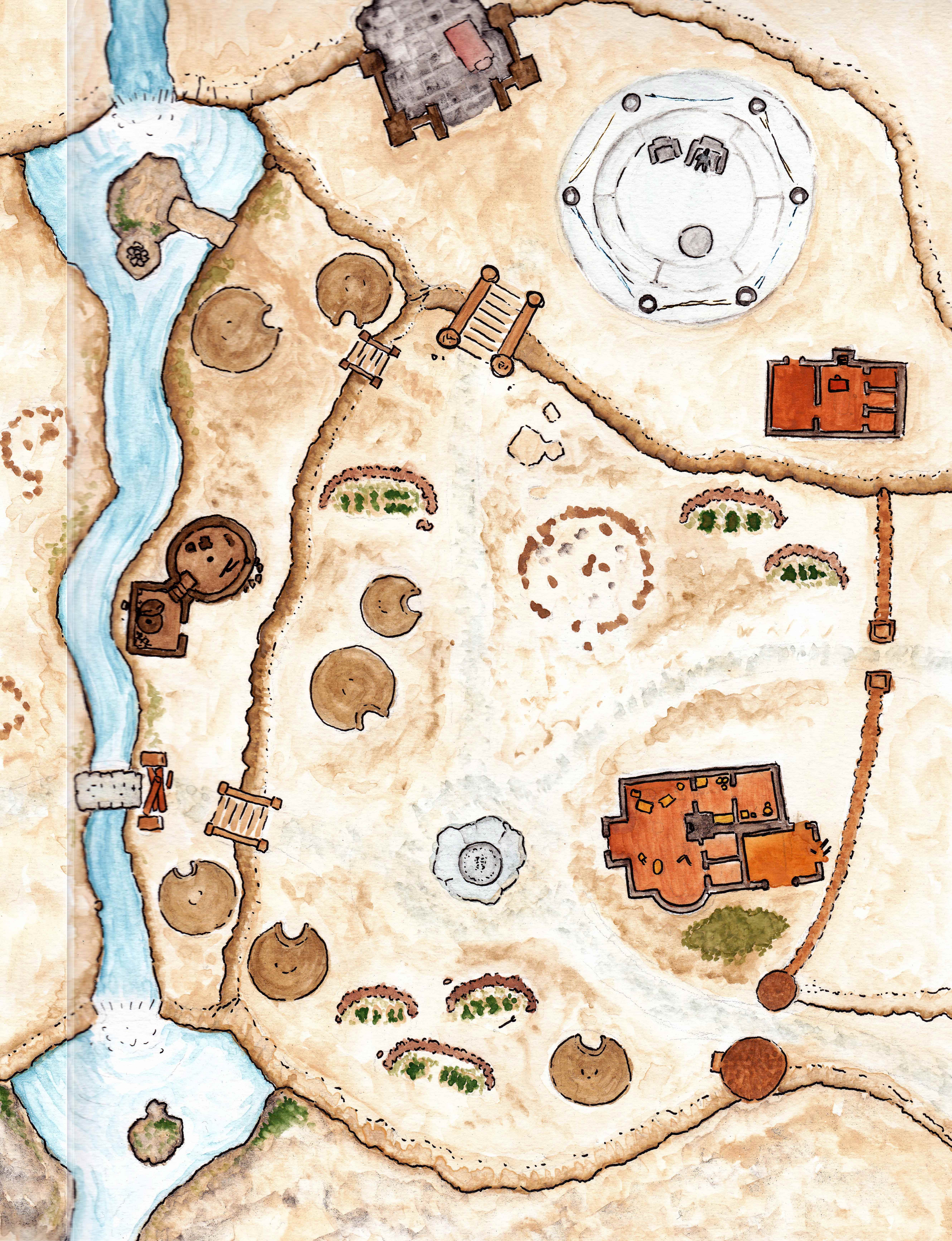
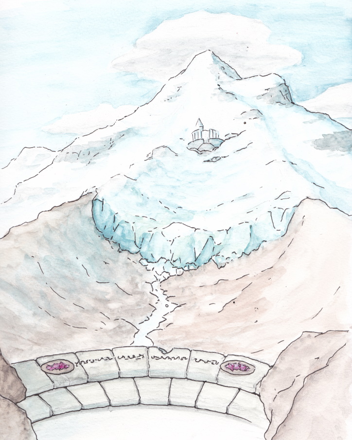
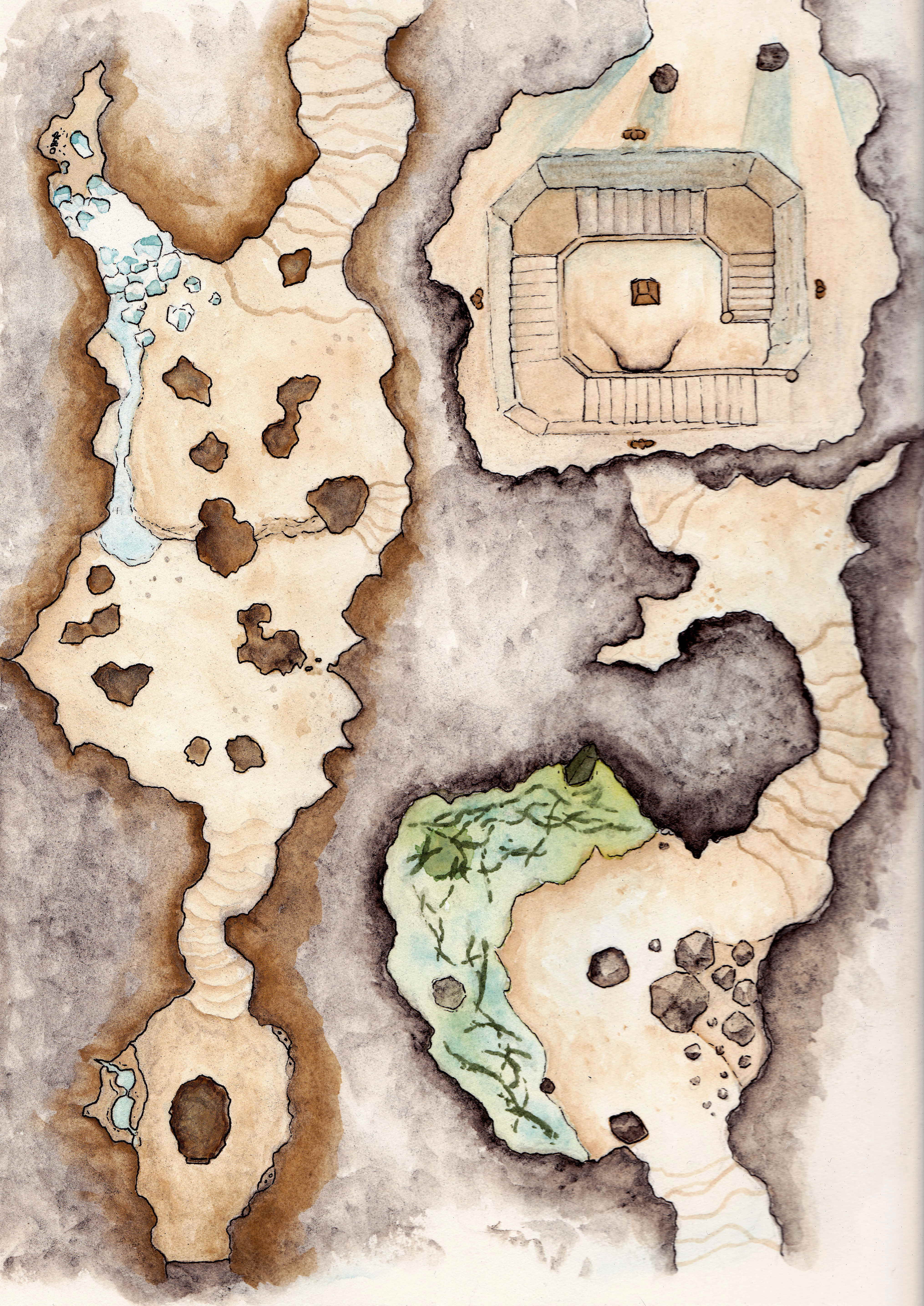
Some larger maps and setpieces, especially in the approach to a shrine high in the mountains. Softer colours, but I've no idea how light works.
The larger watercolour paper is a bit more awkward to work with - and just slightly larger than the scanner. The texture it adds is sometimes frustrating, but often helps with more natural environs.
Outlines were added afterwards with a fineliner
 |
 |
 |
|
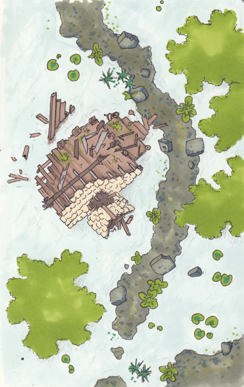
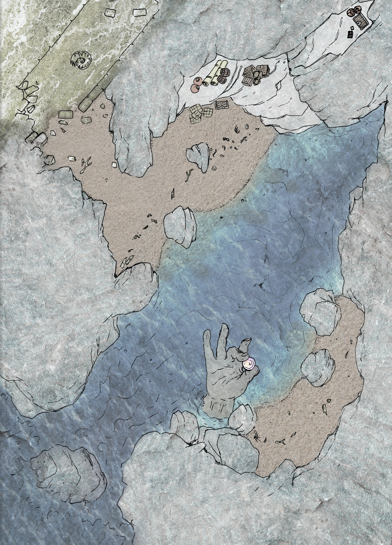
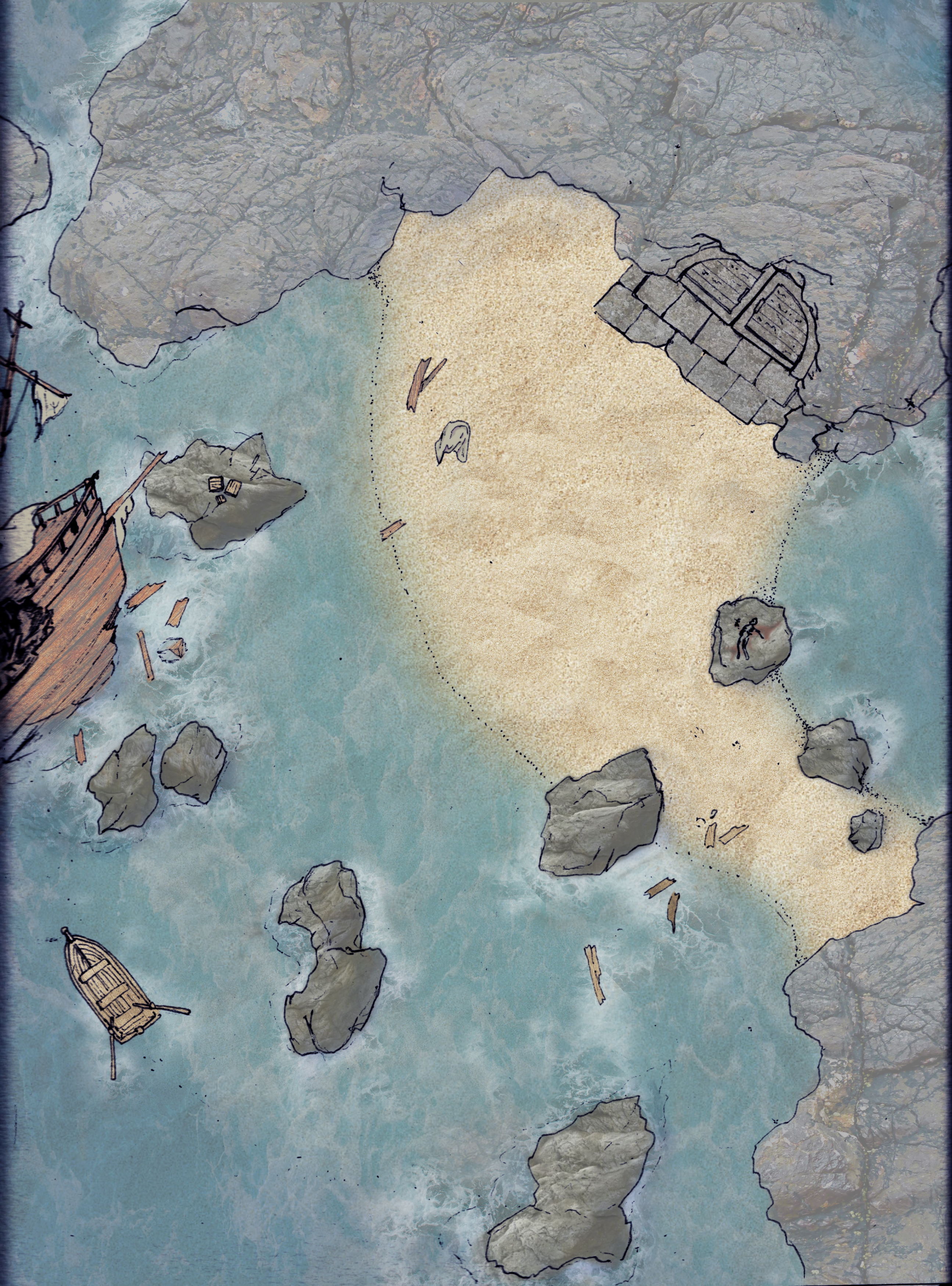
An experiment in speeding up the process of making a custom map. The outlines were done first, scanned, then layers of digital textures were slapped together in Krita or Paint.net and erased/blended.
I like the water effects and gritty, crunchy feeling, and I think it is slightly faster than any other method for filling the map with functional indicators of terrain type. A properly curated library of custom textures would help immensely, rather than frenzied searching on the web for appropriately licensed images.
These areas were a sea cave near a coastal town, and a series of rocky outcrops and sandbars around an old giant colony. The sand, rock and water all worked reasonably with the photo textures.
 |
 |
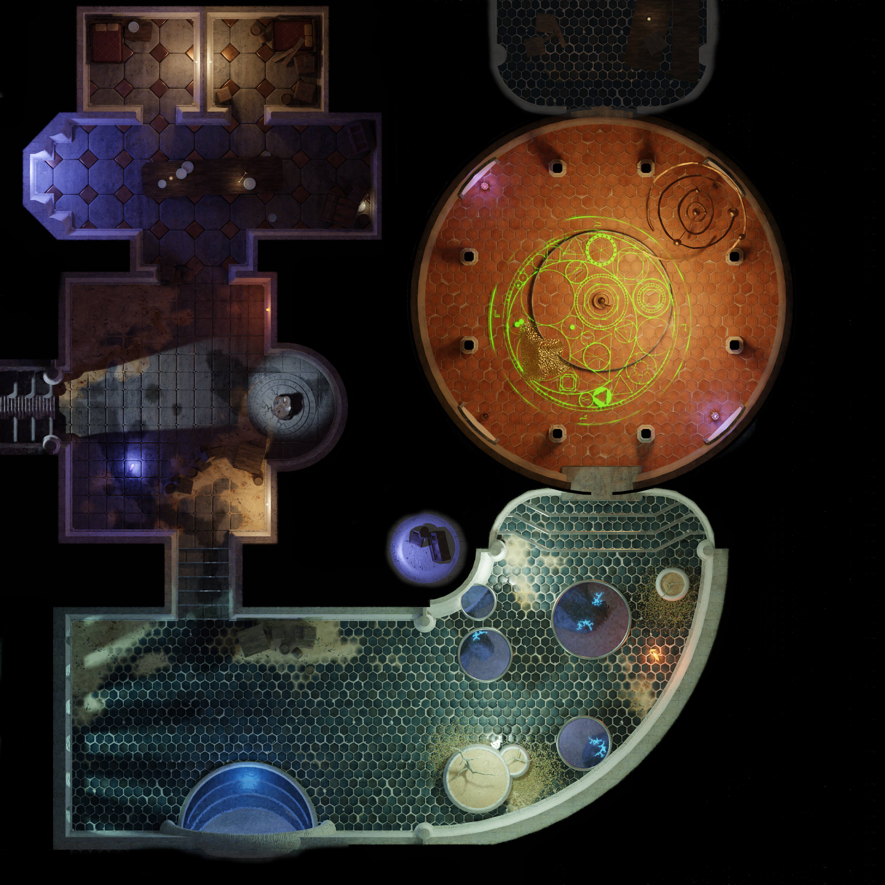
Another experiment, this submerged storm giant hall was modelled in Blender and rendered with an orthographic camera.
By far the slowest method so far, the ability to play with lighting and rapidly blend materials and wetness were fun. With more modelling experience or a developed asset library, this could be useful in the future.
 |